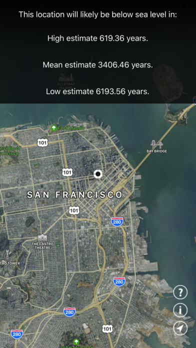


This application is a quick and easy utility to check when a location will be under the global mean sea level.
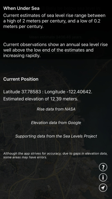
The app uses a current estimate range from NOAA and NASA, for a low estimate of 0.2 m per century and a high estimate of 2.0 m per century. Current observations of global mean sea level rise are 0.34 m per century and rising rapidly.
The app uses data from Apple Maps, NASA, NOAA, Google Elevations, and The Sea Levels Project. In some areas, and at some latitudes data may be at lower resolution than others.